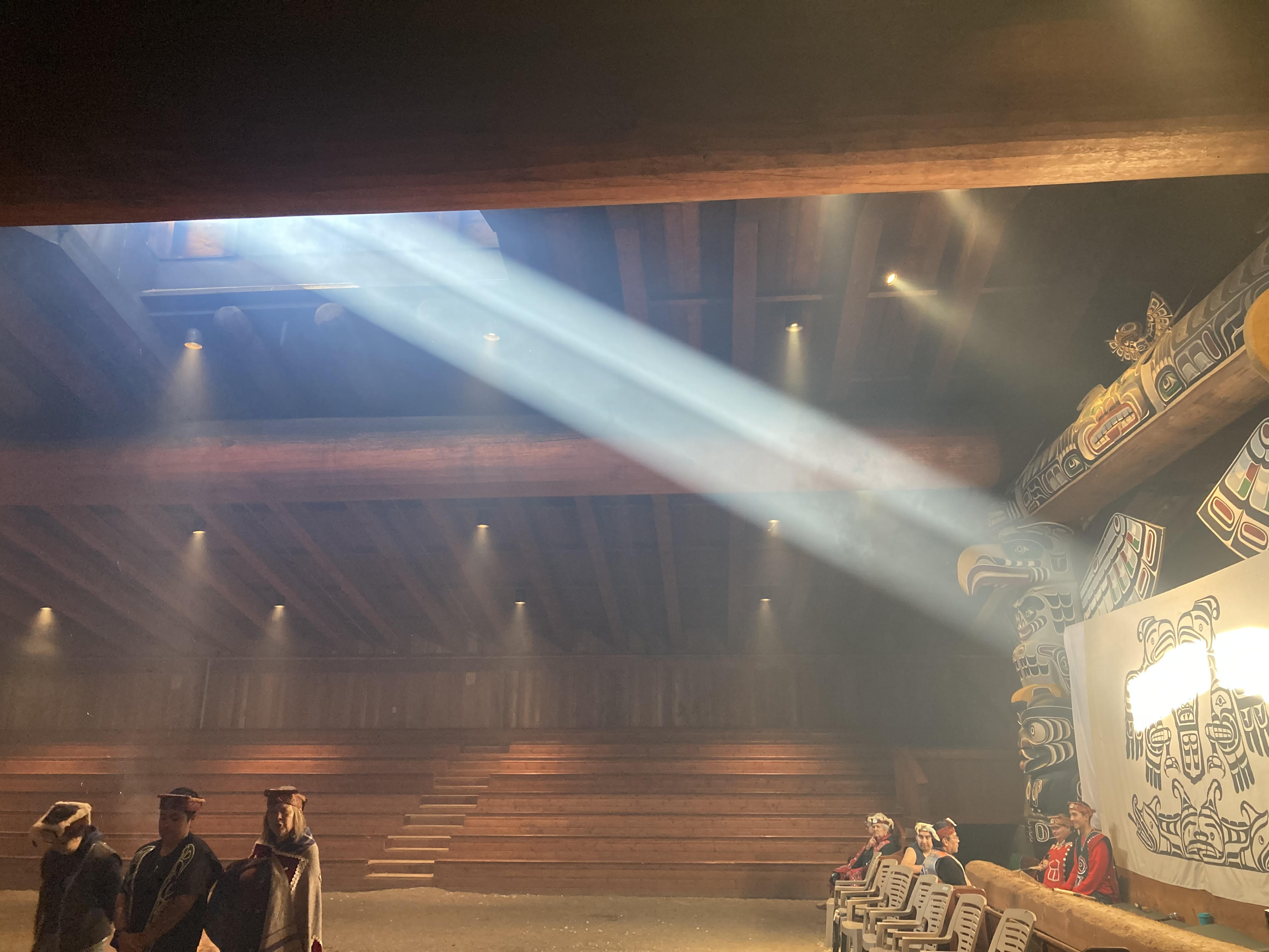
Smoke pours from the double doors. A fire lights up the dim interior of the Alert Bay Big House. A pair of totems adorned with thunderbirds glare from the far wall. Cedar logs crack and sparks lift skyward toward the hole in the roof.
I step away as the doors close and the thunderbirds disappear. I know what I’m missing: 60 minutes of the Northwest Coast brought to life through the songs, dances, and regalia of the Namgis First Nations. To the shock of no one, my favorite is the “Salmon Dance,” complete with a carved wooden orca that chases sockeye across the dirt floor with remarkable authenticity while nine community elders pound in unison on a booming drum.
A steady mist falls. The muffled voices inside the walls go quiet. I turn and walk across a vacant soccer field and down a dirt road. I can see the islands beyond Cormorant Pass. All those names that make my heart pound and ache.
Plumper Islands. Weyton Pass. Robson Bight. Blackfish Sound. Hanson Island. Johnstone Straight. I am back where it all began.
I was born on the northeast coast of Vancouver Island, where the tides bottleneck through archipelagos and ancient fjords. Alaska may be home, but my dalliances with this place will never end.
Blackberry bushes infest the roadside ditches and stretch to the beach. Stacks of cedar and fir abandoned on the full moon tide guard a pebbled shore. I navigate the logs and turn left. I doubt what I’m looking for will still be there. I can’t decide if I want it to be. I glance at the note on my phone dated two years previous. Something kept me from exterminating this little artifact.
End of the road. Turn left. Approximately 100 paces. Look for a cedar tree with a split top. It’s a large piece of fir bark resting on the trunk.
“98… 99…100…”
There it is. The tree must be half a century old. The most precious commodity on the coast was and is an old-growth cedar. House posts, canoes, hats, clothing, baskets. It can be lived beneath, paddled, worn, and carried. No wonder Indigenous cultures revere it. I try to imagine a world older than this cedar. When the banks of the nearby Nimpkish River swelled with sockeye and the Namgis butterflied their fillets before cooking them over open fires. It must’ve felt like a miracle: food arriving at the front door every summer as the Tree of Life grew abundantly. The resources seemed limitless until we tried to feed and house the world instead of a community.
I put a hand on the cedar and stroke the sinewy outer bark. There aren’t many 500-year-old cedars left. This tree was a sapling when Columbus sailed the ocean blue. The forked trunk split as Washington crossed the Delaware. It listened to the chainsaw’s ceaseless roar as the forests of Cormorant Island fell in the name of siding and firewood.

I peer around the trunk and feel the familiar tugs of anxiety and longing. My teeth dig into my lips until I taste iron.
Pick it up. You’ve come this far.
I bend over and grab the slab of fir bark I placed here two years ago. It holds memories, just like everything on this coast. I can’t look at a fir tree and not remember combing Hanson Island’s shorelines for this bark known as “fisherman’s coal.” Stacked on top of a woodstove’s roaring flames, a couple of large pieces kept our cabin at Orca Lab toasty at night.
Memories domino: padding down the dark, narrow stairs to check the fire. The rabbit cage in the corner tucked beneath the windows. Penny nestled in her litter box, soft brown ears twitching. The hydrophone speaker above the bed and the ocean sounds bubbling through the cabin. Wind and rain on the roof. Deer on the beach. Harlequin ducks in the cove. The boat runs to Alert Bay to resupply. A hot bath. A sandwich and beer with my hero Paul Spong.

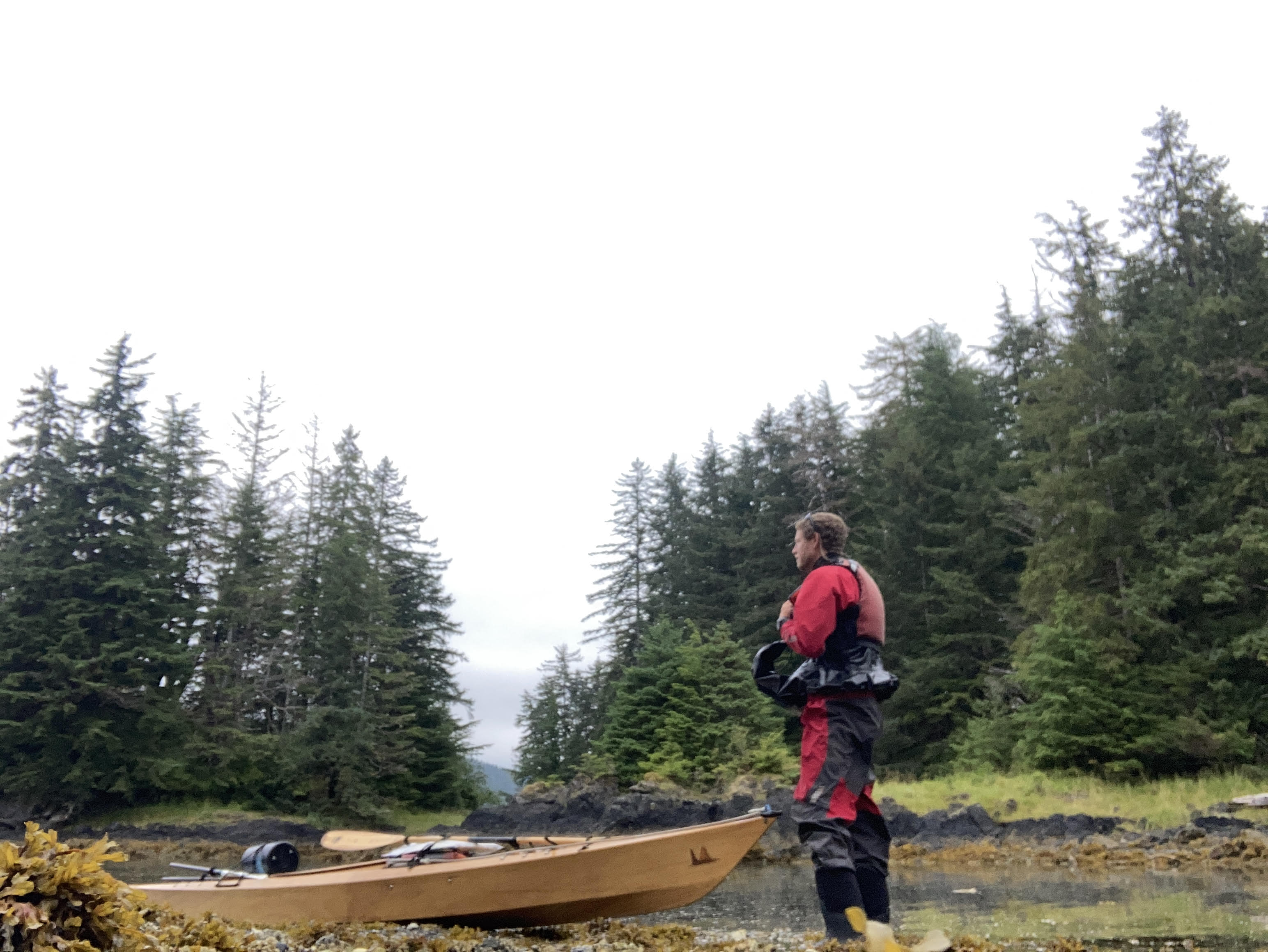
I pull myself from the past like a diver breaking the surface. Stalling, I look across the water at the islands I hold dearly. Hanson Island hovers on the horizon. Orca Lab, that cabin, is just a few miles away. I could be there in a few hours if I stole (excuse me, “borrowed”) a kayak.
The hypothetical brings me back to the slab of fir bark. I flip it over and run my fingers across the smooth brown surface. Someone has scrawled an untidy message into it. The penmanship is mine, but that’s where the similarities end.
I had vowed we’d return here and finish what we’d started. The Orca Lab caretaking era was supposed to be nothing more than a kayaking trip until it grew into so much more. But we never did get that paddle trip. Two years ago, when I returned to Alert Bay for the first time in five years, I scribbled this vow that we’d paddle here. I’d imagined finding this piece of bark and celebrating before we walked the familiar road to Paul and Helena’s house to laugh and reminisce.
The unfulfilled message has stuck in my mind like a sliver. Something insisted on finding it, making peace, and sending it on its way.
“Now what?” I ask the falling tide.
There’s no answer. No divine sign, magic rainbow, or miracle dorsal fin. I don’t expect one. I don’t need one. I flip the wood into the water and walk down the beach without a second glance. Not everything needs a proper burial.
***
Three hours later, the National Geographic Venture cruises east in Johnstone Strait, Hanson Island’s shoreline gliding past. I am giddy. My eyes ping pong between the spotting scope and my phone. I’m cheating. Thanks to Orca Lab’s streaming camera, I know orcas are swimming south towards Blackney Pass from Blackfish Sound. I watch them on my phone’s tiny screen before pushing my eyes to the scope. I find them at the east end of Hanson Island. Dorsal fins. Right where they’re supposed to be. One, two, three, four, five. I reflexively catalog them. Three females, one juvenile, and one adult male.

I should say something. It’s the only reason I’m on this boat. But I savor it a beat longer than I should. For 60 seconds, it’s just me and these five whales. They split the surface, the male raising his tail and slapping the surface. I permit a moment of anthropomorphism and tell myself he’s waving at me. Perhaps I am looking for that divine sign.
“Hey guys…” I radio to the bridge team. “We found them.”
A flurry of activity. An excited announcement rings through the boat. An orderly rush of binoculars and baseball bat-sized lenses arrive on the bow. But as the Venture turns into Blackney Pass, the orcas turn toward the Hanson Island shore.
I gaze across the pass toward Cracroft Point, remembering the dead wolf pup we found there. Off the bow is Parson Island, solar panels and remote camera visible on the cliff where I lugged eight backbreaking batteries, savoring every step and stumble.
We round the point… and there it is. From here, Orca Lab looks just as it did when I pulled away in April 2017. I think of that piece of fir bark floating in the current, reconciling memories, joy, and grief. How does one savor memories without drowning in them? And if those memories lead to stark regret, why would I watch?

The clicking of cameras fades into the ether. It’s still just me and those orcas. The Lab in the background with its observation deck and recording studio where I spent sleepless nights staring across a black ocean with chattering whales in my ears.
I step away from the scope, and my spot is immediately filled. The soothing bass of breathing orcas pirouettes across calm water and floats over the bow.
“If we’re quiet… we can hear them,” I say to no one in particular.
Why would I watch? Why do I watch? How long will I continue to watch?
The calf rockets from the water and hovers briefly before sending white water geysers high. I couldn’t stop watching, even if I wanted to. Couldn’t look away if my life depended on it. And if these animals, these places, these memories… if they bring a twinge of heartbreak syndrome from time to time… then that’s the bargain I’ll strike.
My fingers twitch, grasping at an invisible kayak paddle. The fir bark promise doesn’t need to go unfulfilled. The only thing keeping me from retracing these shorelines is the person rooted to the deck.